Tropical Track & Forecast
Interactive - 5 Day Track Forecast Cone / Coastal Watches & Warnings

Coastal Watches/Warnings and 5-Day Forecast Cone for Storm Center

[columns] [column_item col=6]
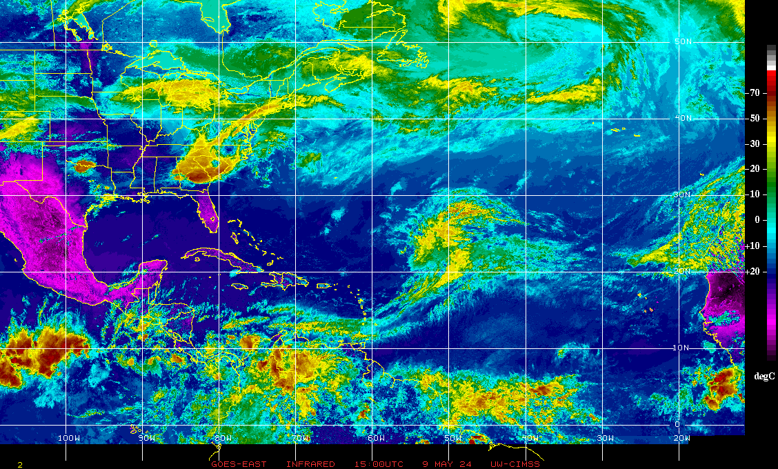
Current Infrared Satellite Image 2014 Tropical Cyclone Tracks
Atlantic Tropical Weather OutlookNational Hurricane Center - Atlantic Tropical Weather Outlook
|
Latest Tropical Weather Outlook[columns] [column_item col=6] |
|
[columns] [column_item col=6] Probability of Formation 0-24hrs
Probability of Formation 24-48hrs
|
Graphical Tropical Weather Discussion

NHC Tropical Weather Discussion (Atlantic)
National Hurricane Center - Tropical Weather Discussion (Atlantic)-
NHC Atlantic Tropical Weather Discussion
000
AXNT20 KNHC 262111
TWDAT
Tropical Weather Discussion
NWS National Hurricane Center Miami FL
0005 UTC Sat Jul 27 2024
Tropical Weather Discussion for North America, Central America
Gulf of Mexico, Caribbean Sea, northern sections of South
America, and Atlantic Ocean to the African coast from the
Equator to 31N. The following information is based on satellite
imagery, weather observations, radar and meteorological analysis.
Based on 1800 UTC surface analysis and satellite imagery through
2010 UTC.
...TROPICAL WAVES...
An eastern Atlantic tropical wave is along 22.5W, south of 22.5N
to across the eastern Cabo Verde Islands, moving west at 15-20
kt. Convection is described in the Monsoon Trough/ITCZ section.
An eastern Atlantic tropical wave has its axis along 34.5W, south
of 22N, moving slowly west at 5-10 kt. Convection is described in
the Monsoon Trough/ITCZ section.
A central Caribbean tropical wave has its axis along 78.5W, south
of 20N, moving quickly westward at 20-25 kt. Scattered moderate
convection, likely enhanced by the Colombian/Panamanian Low and
the East Pacific Monsoon Trough, is noted in the SW Caribbean from
the coast of Panama north to 12N west of 75W, and from 14N to 17N
between 70W and 75W.
...MONSOON TROUGH/ITCZ...
The monsoon trough enters the Atlantic near Dakar, Senegal and
continues southwestward to 09N47W. The ITCZ extends from 09N47W
to the coast of Guyana near 06N58W. Scattered moderate convection
is present from 06N to 13N and between 23W and 50W.
GULF OF MEXICO...
A surface trough located offshore Texas and Louisiana continues
to support scattered moderate convection across the NW Gulf, north
of 27N and west of 86W. Elsewhere, weak surface troughs are in
the NE Gulf and Bay of Campeche. Surface ridging prevails,
providing light to gentle E Winds and seas of 1-3 ft.
For the forecast, a ridge will remain in place across the Gulf
waters through Wed allowing for gentle to moderate winds and
slight to moderate seas. Winds will freshen up at night off NW
Yucatan over the next several days. A weak high pressure cell will
develop over the eastern Gulf by Sun.
CARIBBEAN SEA...
Please see the TROPICAL WAVES section above.
Earlier scatterometer data depicted ongoing fresh to strong
trades in the central Caribbean with resultant seas of 6-8 ft in
this area of wind. Elsewhere, trades are gentle to moderate with
3-6 ft seas.
Weather conditions continue to support the potential for heavy
rainfall over the southwest Caribbean, including western Panama
and Costa Rica through Sat, and over eastern Nicaragua and
northeast Honduras Sat into Sun. This rain could be significant,
causing flooding and possible mudslides. Please refer to your
local and national meteorological agency for details.
For the forecast, a tropical wave will move across the western
Caribbean on Sat, reaching the Yucatan Peninsula on Sun. The
Atlantic ridge will build over the east and central Caribbean in
the wake of the wave. This pattern will support fresh to strong
trade winds and rough seas across the central Caribbean into the
middle of next week. Expect moderate to fresh E to SE winds and
building seas over the northwest Caribbean behind the wave axis
through Sun with locally strong winds and rough seas across the
Gulf of Honduras Sun night.
Looking ahead, an area of disturbed weather over the central
tropical Atlantic Ocean is expected to interact with an
approaching tropical wave during the next several days. Some
development of this system will be possible while it approaches
the Lesser Antilles during the early to middle part of next week
and moves generally west-northwestward near the Greater Antilles
toward the latter part of the week.
ATLANTIC OCEAN...
A surface trough located beneath a broad upper level low near the
central Bahamas is supporting clusters of showers and
thunderstorms from 22N to 29N between 67W and 79W. The remainder
of the tropical Atlantic is dominated by a classic summer
Bermuda-Azores high centered along 31N. Gentle to moderate trades
prevail across the basin, except moderate to fresh south of the
monsoon trough between 25W and 35W. Seas are 4-6 ft across the
open Atlantic, except to 7 ft in the moderate to fresh monsoonal
winds, and also to 7 ft east of the northern Leeward Islands. Seas
are less than 4 ft west of the Bahamas and in the Straits of
Florida.
For the forecast west of 55W, the Bermuda-Azores high will
dominate the Atlantic forecast waters through the next several
days. It will shift eastward ahead of a weak cold front moving off
the Carolina coast on Sat. The front will stall over the N waters
W of 70W on Mon while dissipating. The pattern will support fresh
to strong E winds off Hispaniola through Sun, and gentle to
moderate breezes elsewhere into Tue. Looking ahead, winds and seas
may increase northeast of the Leeward Islands by late Tue
associated with an approaching tropical wave.
Looking ahead, an area of disturbed weather over the central
tropical Atlantic Ocean is expected to interact with an
approaching tropical wave during the next several days. Some
development of this system will be possible while it approaches
the Lesser Antilles during the early to middle part of next week
and moves generally west-northwestward near the Greater Antilles
toward the latter part of the week.
$$
Lewitsky


 [/column_item] [column_item col=6]
 [/column_item] [/columns]
 [/column_item] [column_item col=6]
 [/column_item] [/columns]